Average Ratings 0 Ratings
Average Ratings 0 Ratings
Similar Products
-
BorealisAll stakeholder engagement activities can be managed from one platform. Additional modules can be added to strengthen governance, environment, and social areas. Borealis' Stakeholder Engagement module gives you the tools to create more effective engagement plans, strengthen relationships with stakeholders, and align processes with industry best practice. To simplify your day, the Stakeholder Engagement module centralizes all stakeholder information and makes it easily accessible. Build stakeholder trust with a proven methodology Plan Connect engagement strategy to execution. The mapping tool in Borealis makes it easy to analyze stakeholders to prioritize the allocation of resources. Engage Communicate with stakeholders in a more relevant and timely manner. Borealis uses AI-driven machine learning to keep records clean and up-to-date. Measure Prove compliance with ever-evolving standards. Borealis lets you easily track and progress, generate reports and documentation, and demonstrate the impacts of your efforts.
-
PVcasePVcase Ground Mount is an AutoCAD-based software that allows you to design solar power plants at utility scale. It allows solar engineers to reduce project costs and increase reliability while improving solar plant performance. Realistic, terrain-based PV layouts can reduce project uncertainty and eliminate design errors. Great solar designs can be ruined by poor CAPEX. Get a clear breakdown of the project costs early. Optimize your design and assess potential near-shading issues. Streamline your electrical design by streamlining string mapping and device placement. You can easily download and share cable runs, piling lengths and other cost estimates with your team. PVsyst allows you to export your PV design in a custom format.
-
DashboardFoxDashboards, codeless reports, interactive visualizations, data security, mobile access and scheduled reports. DashboardFox is a dashboard- and data visualization tool for business users. It comes with a no-subscription pricing plan. You only pay once and the software is yours for life. DashboardFox can be installed on your own server behind your firewall. Are you looking for Cloud BI? We offer managed hosting, but you retain ownership of your DashboardFox data and licenses. DashboardFox allows users to drill down and interact with live data visualizations through dashboards and reports. Without requiring any technical knowledge, business users can create new visualizations in a codeless builder. Alternative to Tableau, Sisense and Looker, Domo. Qlik, Crystal Reports, among others.
-
QlooQloo, the "Cultural AI", is capable of decoding and forecasting consumer tastes around the world. Privacy-first API that predicts global consumer preferences, catalogs hundreds of million of cultural entities, and is privacy-first. Our API provides contextualized personalization and insight based on deep understanding of consumer behavior. We have access to more than 575,000,000 people, places, and things. Our technology allows you to see beyond trends and discover the connections that underlie people's tastes in their world. Our vast library includes entities such as brands, music, film and fashion. We also have information about notable people. Results are delivered in milliseconds. They can be weighted with factors like regionalization and real time popularity. Companies who want to use best-in-class data to enhance their customer experiences. Our flagship recommendation API provides results based on demographics and preferences, cultural entities, metadata, geolocational factors, and metadata.
-
Amazon ElastiCacheAmazon ElastiCache enables users to effortlessly establish, operate, and expand widely-used open-source compatible in-memory data stores in the cloud environment. It empowers the development of data-driven applications or enhances the efficiency of existing databases by allowing quick access to data through high throughput and minimal latency in-memory stores. This service is particularly favored for various real-time applications such as caching, session management, gaming, geospatial services, real-time analytics, and queuing. With fully managed options for Redis and Memcached, Amazon ElastiCache caters to demanding applications that necessitate response times in the sub-millisecond range. Functioning as both an in-memory data store and a cache, it is designed to meet the needs of applications that require rapid data retrieval. Furthermore, by utilizing a fully optimized architecture that operates on dedicated nodes for each customer, Amazon ElastiCache guarantees incredibly fast and secure performance for its users' critical workloads. This makes it an essential tool for businesses looking to enhance their application's responsiveness and scalability.
-
OdooOdoo is an open-source, fully customizable and extensible software that includes hundreds of professionally designed business applications. Odoo's intuitive database can meet most business needs including CRM, Sales, Projects, Manufacturing, Inventory, Accounting, and Accounting. Odoo is a software solution that can be used to meet all company needs, regardless of size or budget. Odoo's seamless design makes it easy for businesses to become more efficient and save time. Each module is interconnected to offer a seamless experience from one app to the next. Users can automate many tasks that would otherwise require manual inputs to multiple applications. Odoo enables teams to collaborate with each other from one platform, allowing them to keep all business functions in one place.
-
TwilioUse the language you already love to prototype ideas quickly, develop production-ready communications applications, and run serverless applications on one API-powered platform. Twilio is a single fully-programmable platform with flexible APIs for any channel, built-in intelligence, and global infrastructure to support you at scale. Quickly integrate powerful APIs to start building solutions for SMS and WhatsApp messaging, voice, video, and email. Browse documentation and SDKs in multiple coding languages, including Ruby, Python, PHP, Node.js, java, and C#, or jumpstart your first project with our open source code templates to quickly build production-ready communications apps. Consult our community of over 9 million developers for guidance and inspiration on your next project. Sign up and start building today.
-
Windsurf EditorWindsurf is a cutting-edge IDE designed for developers to maintain focus and productivity through AI-driven assistance. At the heart of the platform is Cascade, an intelligent agent that not only fixes bugs and errors but also anticipates potential issues before they arise. With built-in features for real-time code previews, automatic linting, and seamless integrations with popular tools like GitHub and Slack, Windsurf streamlines the development process. Developers can also benefit from memory tracking, which helps Cascade recall past work, and smart suggestions that enhance code optimization. Windsurf’s unique capabilities ensure that developers can work faster and smarter, reducing onboarding time and accelerating project delivery.
-
Azure AI SearchAchieve exceptional response quality through a vector database specifically designed for advanced retrieval augmented generation (RAG) and contemporary search functionalities. Emphasize substantial growth with a robust, enterprise-ready vector database that inherently includes security, compliance, and ethical AI methodologies. Create superior applications utilizing advanced retrieval techniques that are underpinned by years of research and proven customer success. Effortlessly launch your generative AI application with integrated platforms and data sources, including seamless connections to AI models and frameworks. Facilitate the automatic data upload from an extensive array of compatible Azure and third-party sources. Enhance vector data processing with comprehensive features for extraction, chunking, enrichment, and vectorization, all streamlined in a single workflow. Offer support for diverse vector types, hybrid models, multilingual capabilities, and metadata filtering. Go beyond simple vector searches by incorporating keyword match scoring, reranking, geospatial search capabilities, and autocomplete features. This holistic approach ensures that your applications can meet a wide range of user needs and adapt to evolving demands.
-
Shape SoftwareShape Software's purpose-built sales and marketing automation software empowers you to manage all aspects of your business from one platform. The cloud-based software from Shape offers many tools to help you manage and automate your online marketing, promotions via text, email and digital marketing ads, capture leads from online sources, nurture prospects and customers and project manage your day. You can also offer customers a secure portal to streamline your intake processes, systematically score leads with ShapeIQ, and run detailed custom reporting. Start growing your revenue with Shape's flexible suite of services today.

Description
GeoPandas is a community-driven open-source initiative designed to simplify the handling of geospatial data within Python. By expanding upon the data types available in pandas, GeoPandas facilitates spatial operations on geometric data types. The library utilizes shapely for executing geometric functions, while it relies on fiona for file management and matplotlib for visualization purposes. The primary aim of GeoPandas is to streamline the process of working with geospatial data in Python. This tool integrates the functionalities of both pandas and shapely, allowing users to perform geospatial tasks seamlessly within the pandas framework and providing an accessible interface for various geometric operations through shapely. With GeoPandas, users can conduct operations in Python that typically would necessitate a spatial database like PostGIS. The project is supported, developed, and utilized by a diverse global community of individuals with varying expertise. It remains committed to being fully open-source, available for everyone to utilize, and is released under the permissive BSD-3-Clause license, ensuring its continued accessibility and growth. As such, GeoPandas serves as a powerful resource for anyone looking to work with geospatial data in a user-friendly manner.
Description
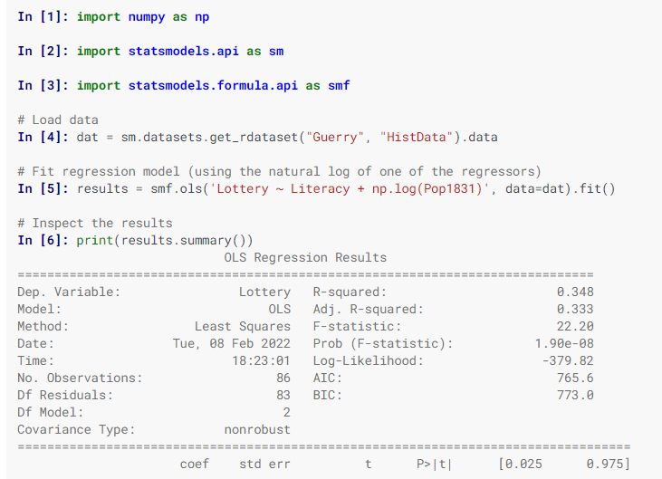
Statsmodels is a Python library designed for the estimation of various statistical models, enabling users to perform statistical tests and explore data effectively. Each estimator comes with a comprehensive array of result statistics, which are validated against established statistical software to ensure accuracy. This package is distributed under the open-source Modified BSD (3-clause) license, promoting free use and modification. Users can specify models using R-style formulas or utilize pandas DataFrames for convenience. To discover available results, you can check dir(results), and you will find that attributes are detailed in results.__doc__, while methods include their own docstrings for further guidance. Additionally, numpy arrays can be employed as an alternative to formulas. For most users, the simplest way to install statsmodels is through the Anaconda distribution, which caters to data analysis and scientific computing across various platforms. Overall, statsmodels serves as a powerful tool for statisticians and data analysts alike.
API Access
Has API
API Access
Has API


Pricing Details
No price information available.
Free Trial
Free Version
Pricing Details
Free
Free Trial
Free Version
Deployment
Web-Based
On-Premises
iPhone App
iPad App
Android App
Windows
Mac
Linux
Chromebook
Deployment
Web-Based
On-Premises
iPhone App
iPad App
Android App
Windows
Mac
Linux
Chromebook
Customer Support
Business Hours
Live Rep (24/7)
Online Support
Customer Support
Business Hours
Live Rep (24/7)
Online Support
Types of Training
Training Docs
Webinars
Live Training (Online)
In Person
Types of Training
Training Docs
Webinars
Live Training (Online)
In Person
Vendor Details
Company Name
GeoPandas
Founded
2013
Website
geopandas.org/en/stable/
Vendor Details
Company Name
statsmodels
Website
www.statsmodels.org/stable/index.html
Product Features
GIS
3D Imagery
Census Data Integration
Color Coding
Geocoding
Image Exporting
Image Management
Internet Mapping
Interoperability
Labeling
Map Creation
Map Sharing
Near-Matching
Reverse Geocoding
Spatial Analysis