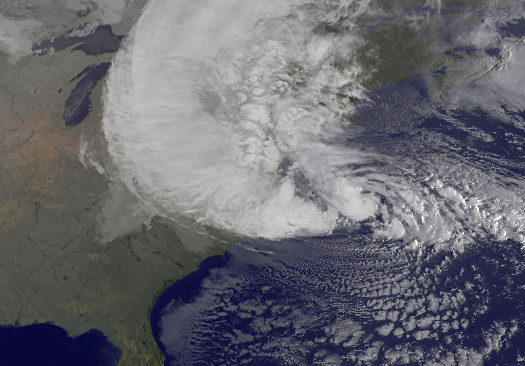
So I measured the two pics in google maps for an approximate estimate of what to my eyeball looked like two pretty big storms, only Irene with a more definite central eye.
From the bottom of Sandy to the top (where, admittedly there's clearly a bit of weak storm cropped, but Irene is clearly a lot wider and more of a spiral, so would win on width)
versus
From the bottom of Irene to the top of the pic.
Both were (very approximately) ~915 miles from top to bottom in those pics.
From the far left of the storm sweep of Sandy to the eye (which is out on its lonesome in the ocean), measured horizontally.
~740
The width of Irene in the shot is massive, and hard to work out due to the coastline being obscured, and similar to the case of Sandy, goes off frame to the right.
But I got, approximately:
~845
Soo. On those pics, again very approximately, ~900x~750 for Sandy and ~900x~850 for Irene. I think they are comparable.
I can tell you that in our part of Maryland, Sandy was mostly a dud. The derecho did more damage to the house and trees - the winds didn't really feel like much at all. I don't think we got any gusts that came close to tropical storm strength.
Not to minimise what happened to New York and New Jersey, just because Sandy clearly covers all of Maryland, to mention that it didn't really feel like much of a storm to us experiencing it in eastern Maryland. The power went out for maybe... 5 minutes. I checked the outtage map along the shore from BGE. There were a number of outtages, but again, not as bad as the derecho.
